While the metric system is great, I live in America, the land of the imperial system. In projects where I want to take DEM GeoTIFFs and create labeled contour lines, it’s nice to have those displayed in feet. Here are the simple steps to convert a GeoTIFF from meters to feet in QGIS:
- Open your DEM files in QGIS
- Raser > Raster Calculator
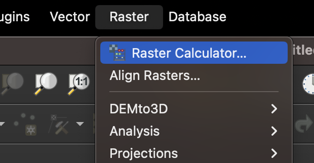
- Select and double-click the layer you want to convert. This will put it below in the Raster Calculator Expression text box
- After your layer name, add
*3.28084, the number of feet in a meter.
- Click OK
- Now you have a new DEM layer in feet instead of meters. You can now use the regular process to add contour lines and labels.